Interactive USA Map: Explore America Like Never Before
peripera
21 May, 2025
No Comments
Interactive USA Map: Explore America Like Never Before
Have you ever dreamed of exploring the vast and diverse landscapes of the United States, all from the comfort of your home? Whether you’re planning a cross-country road trip, studying U.S. geography, or simply want to discover hidden gems across the country, an interactive USA map is your ultimate tool. It’s more than just a digital version of a paper map—it’s an immersive experience that transforms the way we explore America.
In this article, we’ll dive into what makes an interactive USA map so powerful, how it works, and how you can use it to explore the U.S. like never before.
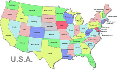
What is an Interactive USA Map?
An interactive USA map is a dynamic, clickable digital map of the United States that lets users explore information by hovering, zooming, clicking, and sometimes even filtering by categories. Unlike static maps, interactive maps provide layers of data—ranging from population stats to historical landmarks—that can be accessed instantly.
These maps are widely used in:
Travel and tourism
Education
Real estate
Business intelligence
Government and research
Whether it’s exploring all 50 states or zooming in to street-level detail in Manhattan, interactive maps offer depth, flexibility, and engagement that static visuals simply can’t match.
Features That Make It Unique
What sets an interactive map apart? Let’s look at some standout features:
🗺️ Zoom and Pan
Forget squinting at a paper map. Zoom in on cities, towns, or even neighborhoods. Pan across the map to jump from coast to coast in seconds.
🔍 Filter by Interest
Want to see only national parks? Or perhaps you’re a foodie looking for the best BBQ spots in Texas? Interactive filters allow users to view the map based on personalized interests.
📍 Clickable States and Cities
Clicking on a state or city reveals pop-ups with detailed information—such as fun facts, historical data, weather conditions, or travel guides.
🎨 Custom Data Layers
Customize your view by toggling layers: highways, airports, climate zones, demographics, and more. Perfect for educators and researchers.
🌐 3D Views and Satellite Imagery
Some platforms integrate satellite views and even 3D terrain modeling. Fly over the Rocky Mountains or get a bird’s-eye view of the Grand Canyon.
How Interactive Maps Are Built
Modern interactive maps are built using a combination of mapping technology, geographic data, and web development tools. Here’s a quick overview:
GIS (Geographic Information Systems): The backbone of any interactive map. It processes geographical data and displays it in visual formats.
JavaScript Libraries: Tools like Leaflet.js, Mapbox, and Google Maps API allow developers to build responsive, interactive elements.
Databases: These store all the information that appears on the map—locations, statistics, images, and more.
Cloud Hosting: To ensure that the map loads quickly and can handle thousands of users, many maps are hosted on cloud platforms like AWS or Google Cloud.
Benefits of Using an Interactive USA Map
🎒 For Travelers
Planning a trip across Route 66? Curious about top-rated museums in Washington D.C.? Interactive maps help travelers explore attractions, get directions, and even find reviews in real-time. No more flipping through outdated guidebooks.
🧠 For Students and Teachers
Learning geography has never been so fun. Interactive maps can turn a bland lesson into an exciting visual journey. Teachers can use maps to teach about state capitals, Native American history, or natural disasters.
🏘️ For Real Estate
Interactive maps help real estate agents and home buyers evaluate neighborhoods by showcasing crime rates, school districts, nearby hospitals, and more.
📈 For Business Owners
Want to identify market gaps or track customer behavior? Many businesses use heatmaps and demographic layers to make smarter decisions.
Exploring America, One Click at a Time
Let’s take a virtual tour of how an interactive USA map can help you discover hidden treasures:
🌄 West Coast Wonders
Zoom into California and discover:
National parks like Yosemite and Sequoia
Tech hubs in Silicon Valley
Coastal towns with scenic beauty, such as Carmel-by-the-Sea
🎶 The Southern Charm
Head down to Tennessee and explore:
The music scene in Nashville and Memphis
Civil rights landmarks
Finger-licking Southern cuisine routes
🌽 Midwest Marvels
In states like Iowa, Kansas, and Ohio, explore:
The Great Lakes region
Agricultural hubs
Amish communities and their traditions
🏞️ Northeast History and Culture
Zoom into Massachusetts, Pennsylvania, or New York:
Learn about the American Revolution
Visit Ivy League universities
Enjoy the fall foliage of Vermont
🌵 The Southwest and Beyond
Check out Arizona, Nevada, and New Mexico:
Route 66 attractions
Desert landscapes and Native American heritage
Grand Canyon viewpoints
Best Platforms to Try an Interactive USA Map
There are many platforms offering immersive interactive USA maps. Here are a few popular ones:
Google Earth: Offers satellite imagery, 3D terrain, and Street View.
Mapbox: Great for developers who want to build their own custom maps.
National Geographic MapMaker: Educational tool with rich layers of geographic data.
Travel.State.Gov: Great for planning safe travel routes and understanding regional travel advisories.
USGS National Map: Provides access to topographic and scientific mapping data.
How to Use It for Your Own Projects
You don’t have to be a tech expert to leverage an interactive USA map. Here are simple use-cases:
Embed it on your travel blog to share routes and tips.
Use it in your classroom for interactive learning modules.
Include it in business presentations to highlight regional opportunities.
Plan events or logistics by analyzing geographic coverage.
Final Thoughts
The United States is vast and endlessly fascinating—from its diverse cultures and breathtaking landscapes to its rich history and innovation. With an interactive USA map, all of this is just a click away. Whether you’re an armchair traveler, a curious student, or a data-driven entrepreneur, these digital tools bring America to life in exciting and accessible ways.
So next time you want to explore the U.S., ditch the old-school atlas. Open up an interactive map and explore America like never before.